
|
STORE |
Pay with PayPal |
| Payments in this STORE can be made through PayPal. You do not need a PayPal account in order to make a credit card purchase from this website. If you do not wish to pay through PayPal, you can send a check or money order directly to me, Les Vilda - my address is at the bottom of this web page. (If you choose to pay me directly, please contact me for shipping charges before sending payment.) If there is a problem with your merchandise when you receive it, please feel free to contact me. THANK YOU! |
| INTERNATIONAL VISITORS - If you live outside the United States, please EMAIL me your order. When I recieve your order email, I will calculate the shipping cost to your address and email you back with the TOTAL cost of your order. If you agree with the shipping cost, you can send me payment via PayPal. When I recieve payment, I will ship your items. THANK YOU! |
B.E.E.R. PARTY PRESIDENTIAL CAMPAIGN SOUVENIRS***(All purchases of "CAMPAIGN SOUVENIRS" are non-refundable)*** |
(Click photo for larger image) |
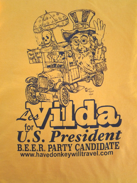
T-Shirts - Gold Mobile Campiagn Headquaters Shirt reads: "LES VILDA for U.S. President - B.E.E.R. Party Candidate". This shirt features a fabulous drawing of the B.E.E.R. Party's Mobile Campaign Headquarters created by Lincoln Highway Johnny of Iowa. (You can see more of his artwork on the website: http://www.hotrodders.com/ ) Since B.E.E.R. Party Supporters are #1, we chose the color Gold to represent "1st Place" - as in a gold medal. (Coincedently, it also happens to be the color of beer. How about that?) These Gold Campaign T-Shirts are made of 100% cotton. At present, they are available in 8 sizes: Small, Medium, Large, X-Large, 2X-Large, 3X-Large, 4X-Large, and 5X-Large. Each....$15.00
|
 (click photo for larger image) |
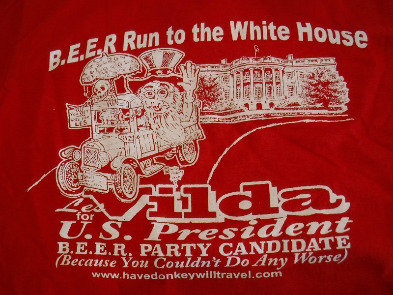
T-Shirts - Red
New
for the 2020 Campaign: B.E.E.R. Run To The White House This shirt reads: "B.E.E.R. Run to the White House - Les Vilda for U.S. President - B.E.E.R. Party Candidate - Because You Couldn't Do Any Worse!" The shirt features a fabulous drawing of the B.E.E.R. Party's Mobile Campaign Headquarters created by Lincoln Highway Johnny of Iowa. It's combined with artwork of the White House and the overall shirt design by Tim Alvis of Nebraska. I decided to go back to my original 2007 color theme of: "AMERICA - Red, White, and Blue" B.E.E.R. Party Supporters are part of what makes America Great; and so, I honor them by returning to the Red, White, and Blue themed T-Shirts. These Red and White Campaign T-Shirts are made of 100% cotton. At present, they are available in 8 sizes: Small, Medium, Large, X-Large, 2X-Large, 3X-Large, 4X-Large, and 5X-Large. Each....$15.00
|
 (click photo for larger image) |
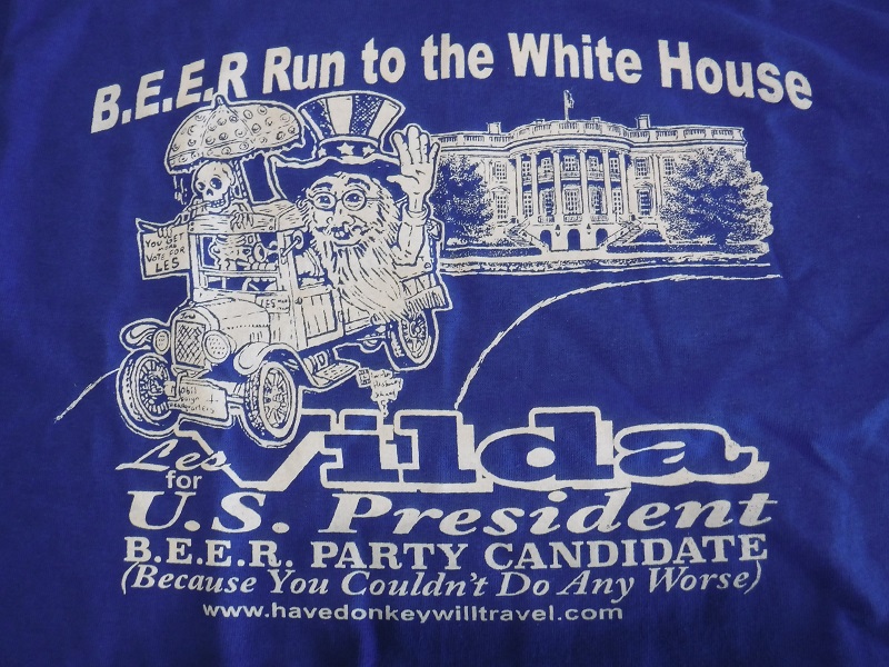
T-Shirts - Blue
New
for the 2020 Campaign: B.E.E.R. Run To The White House This shirt reads: "B.E.E.R. Run to the White House - Les Vilda for U.S. President - B.E.E.R. Party Candidate - Because You Couldn't Do Any Worse!" The shirt features a fabulous drawing of the B.E.E.R. Party's Mobile Campaign Headquarters created by Lincoln Highway Johnny of Iowa. It's combined with artwork of the White House and the overall shirt design by Tim Alvis of Nebraska. I decided to go back to my original 2007 color theme of: "AMERICA - Red, White, and Blue" B.E.E.R. Party Supporters are part of what makes America Great; and so, I honor them by returning to the Red, White, and Blue themed T-Shirts. These Blue and White Campaign T-Shirts are made of 100% cotton. At present, they are available in 8 sizes: Small, Medium, Large, X-Large, 2X-Large, 3X-Large, 4X-Large, and 5X-Large. Each....$15.00
|
|
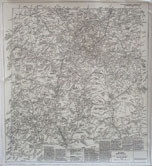
VanArsdale HISTORY MAPS (CLICK HERE to see the descriptions of all 9 of these maps) None of the maps offered here come laminated, matted or framed. They are rolled in a plastic sleeve/tube and shipped in a long square mailing box. When I ship your map(s), I will send you a USPS tracking number. If you wish to order more than 2 maps, please contact me for shipping cost. My contact information is at the bottom of this page. |
|
 |
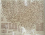
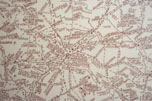
A MAP HISTORY OF AMERICAN INDIAN
TRIBES
(Large - 44"x29")
This is a two color map. Items printed in black are U.S. military extablishments, including dates they were in operation. City and state names are also written in black. Items printed in red indicate informaton about the American Indian tribes. The map shows how various tribes migrated from one area of the U.S. to another in the pre-reservation period of U.S. history. It also shows some of the favorite hunting areas of some tribes and areas of major battles with other Indian tribes and with the whites. The map also contains numerous histoical 'tidbits' about the American Indians. TEMPORARILY OUT OF STOCK Each....$30.00 |
|
A MAP HISTORY OF AMERICAN INDIAN
TRIBES
(Small - 35"x22")
Same as above, but a smaller size. Each....$20.00 |
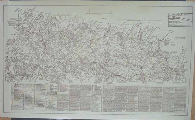 |
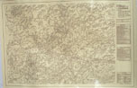
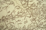
NORTHWEST MAP - (Large - 44.5"x27.5") This map covers the entire states of Washington, Oregon, Idaho, Montana, Wyoming, North Dakota, South Dakota, Minnesota, Iowa, and Wisconsin; and includes the Northern parts of Illinois, Nebraska, Colorado, Utah, Nevada, and California. It covers the time period of 1800 and later. The map includes names and locations of emigrant/overland trails, cattle trails, stage lines, railroads, military forts (years of operation), mining areas, towns, roads, telegraph lines, and home and hunting areas (pre-reservation period) of Native Americans. The map also contains numerous historical 'tidbits'. Each....$30.00 |
|
NORTHWEST MAP - (Small - 34.75"x23") Same description as the Northwest map above, but a smaller size. Each....$20.00 |
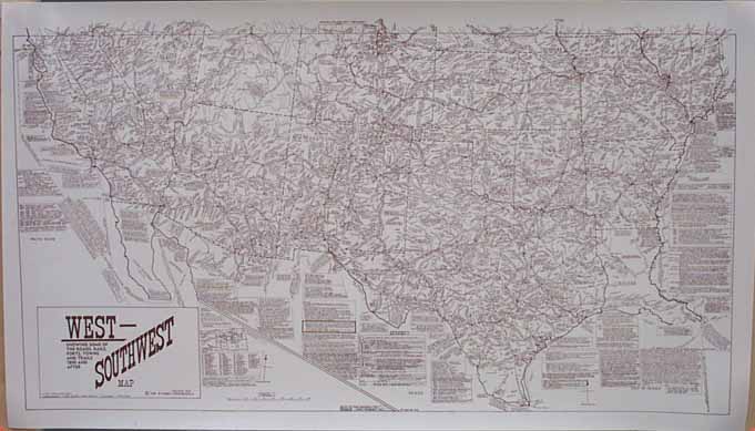 |
SOUTHWEST MAP - (Large - 45"x25.75") This map covers the entire states of Arizona, New Mexico, Texas, Oklahoma, Kansas, Missouri, Arkanasa, and Louisiana; and includes the Southern parts of Illinois, Nebraska, Colorado, Utah, Nevada, and California. It covers the time period of 1800 and later. The map includes names and locations of emigrant/overland trails, cattle trails, stage lines, railroads, military forts (years of operation), towns, roads, telegraph lines, and home and hunting areas (pre-reservation period) of Native Americans. The map also contains numerous historical 'tidbits'. Each....$30.00 |
|
SOUTHWEST MAP - (Small - 35"x20") Same description as the Southwest Map above, but a smaller size. Each....$20.00 |
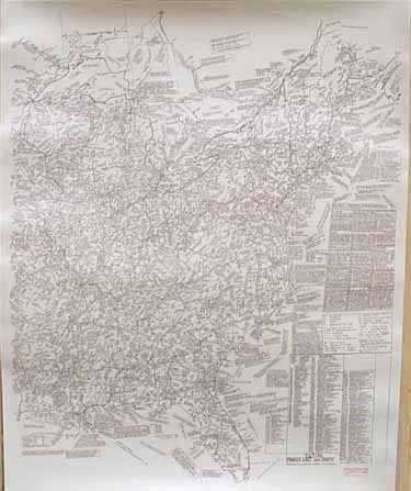 |
EAST/SOUTH MAP - (Large - 35"x43.5") This map covers the Eastern United States to the Mississippi River (plus a short destance West of the river). It covers a time period from the 1500's through the 1800's. The map includes names and locations of railroads, stage lines, canals, overland roads, military forts (years of operation), and towns. It also includes the names and locations of Native American tribes during the pre-reservation period and locations of the present-day reservations (as of the year 1968). The map also contains numerous historical 'tidbits'. Each....$30.00 |
|
EAST/SOUTH MAP - (Small - 23"x29.5") Same description as the East/South Map above, but a smaller size. Each....$20.00 |
|
ILLINOIS MAP - (Large 31" x 42") This map is only the state of Illinois. It contains information dating from before Illinois became a state. The map includes names and locations of emigrant/overland trails, cattle trails, stage lines, railroads, military forts (years of operation), towns, roads, telegraph lines, home and hunting areas (pre-reservation period) of Native Americans, and so much more. The map also contains numerous historical 'tidbits'. Each....$30.00 |
|
 |
ILLINOIS MAP - (Small 22" x 29.75") A smaller size of the Illinois Map. Each....$20.00 |
 |
TEXAS MAP - (Large 37" x 29.75") This map is only the state of Texas. It contains information dating from before Texas became a state. The map includes names and locations of emigrant/overland trails, cattle trails, stage lines, railroads, military forts (years of operation), towns, roads, telegraph lines, home and hunting areas (pre-reservation period) of Native Americans, and so much more. The map also contains numerous historical 'tidbits'. Each....$30.00 |
 |
TEXAS MAP - (Small 28.75" x 23") A smaller size of the Texas Map. Each....$20.00 |
 |
COLORADO MAP - (Large 41.75" x 28") This map is only the state of Colorado. It contains information dating from before Colorado became a state. The map includes names and locations of emigrant/overland trails, cattle trails, stage lines, railroads, military forts (years of operation), towns, roads, telegraph lines, home and hunting areas (pre-reservation period) of Native Americans, and so much more. The map also contains numerous historical 'tidbits'. Each....$30.00 |
 |
COLORADO MAP - (Small 34.25" x 23") A smaller size of the Colorado Map. Each....$20.00 |
 |
NEW MEXICO MAP - (Large 28" x 31") This map is only the state of New Mexico. It contains informations dating from before New Mexico became a state. The map includes names and locations of emigrant/overland trails, cattle trails, stage lines, railroads, military forts (years of operation), towns, roads, telegraph lines, home and hunting areas (pre-reservation period) of Native Americans, and so much more. The map also contains numerous historical 'tidbits'. Each....$30.00 |
 |
NEW MEXICO MAP - (Small 23" x 25.5") A smaller size of the New Mexico Map. Each....$20.00 |
|
ARIZONA MAP - (Large 33" x 39.75") This map is only the state of Arizona. It contains informations dating from before Arizona became a state. The map includes names and locations of emigrant/overland trails, cattle trails, stage lines, railroads, military forts (years of operation), towns, roads, telegraph lines, home and hunting areas (pre-reservation period) of Native Americans, and so much more. The map also contains numerous historical 'tidbits'. Each....$30.00 |
|
|
ARIZONA MAP - (Small 23" x 28.5") A smaller size of the Arizona Map. Each....$20.00
|
|
There are more products to be posted before too long. Please come back to visit again soon!
For further information about any of these products, please contact (email link) Les Vilda. I look forward to hearing from you!
Les Vilda, PO Box 99, Wilber, NE 68465 (402) 821-3058 eduexped@windstream.net